GeoCast - Main Page
|
Purpose
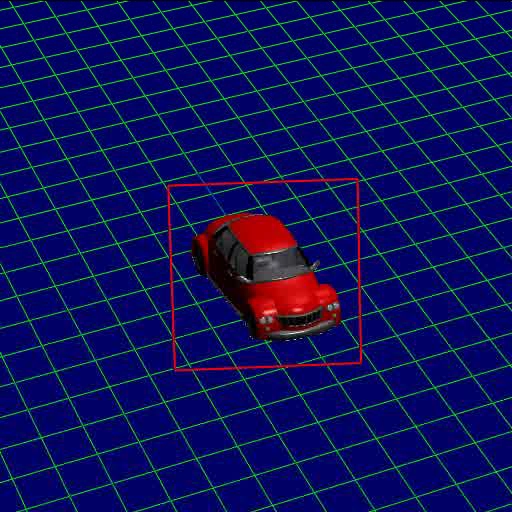
GeoCast is a data format that binds together camera information and multi-layer image sequences, such as RGBZ or RGBA representations. We use OpenEXR for image storage, and represent the camera position, rotation, and lens parameters as text files.
This site hosts the documentation and helper software for GeoCast, a
camera parameter standard for the exchange of extrinsic and intrinsic
camera parameters (even dynamic) across applications.
It is especially useful in applications where computer vision and
computer graphics need to work together to create new data from
2D imagery (aka Visual Computing).
Background

|
GeoCast : A dynamic camera parameter specification.
Gernot Ziegler, Lukas Heidenreich, Marcus Magnor and Hans-Peter Seidel
GeoCast: Unifying Depth Video with Camera Meta-Data
In: 2nd Workshop on Immersive Communication and Broadcast Systems, Berlin, Germany, Heinrich-Hertz-Institute, Berlin, 2005, 0-4
Abstract:
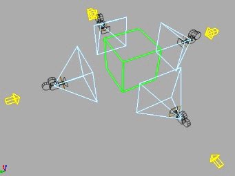
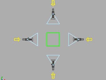
We present a storage format for placing multiple, dynamic 2.5D point sample streams (e.g. RGBZ video) or color video projections into the context of a common world space. The approach utilizes the concept of projective geometry to let virtual projectors "cast" the data from where it was originally recorded by the involved cameras. We exemplify the data format's versatility by demonstrating how several moving cameras reproduce 3D geometry exported from modeling software, and outline the extension to real-world acquisition. We also explain how this format can act as common interchange format for the camera parameters of lightfield/multi-view video footage.
|
Presentations
Power Point Presentation (3DTV Project Meeting, Saalfelden, Austria)
Documentation
For the purpose of documenting libgeocast and the exporter programs a little bit more, we've created a
Wiki where you can find useful information. If you want to download the scripts, see below.
The Wiki itself is structured the following way:
Description of the internal tags of the format
libgeocast - Describes the installation
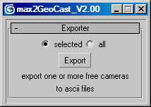
GeoCast 3ds Max Camera Exporter 2.0
GeoCast Maya Camera Exporter 0.1

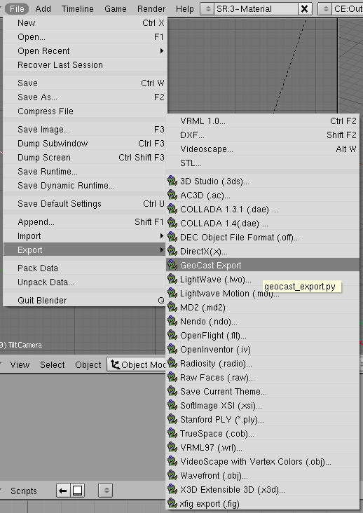
GeoCast Blender Camera Exporter 0.15
Downloads
You can download the exporter scripts for GeoCast here. For the documentation, this refer to the Wiki.
GeoCast Blender Camera Exporter 0.15
GeoCast 3ds Max Camera Exporter 2.01
GeoCast Maya Camera Exporter 0.1
Matlab to GeoCast Camera Converter
Note: For using the Matlab to GeoCast Camera Converter, you'll need the Camera Calibration Toolbox for Matlab.
Demo material
Related sites
Discussion
Pleae join the mailing list geocast-devel.
NEWS:
- 20070410: created wiki.
- 20060311: added movies, presentations, mailing list.
- This page has been created.
|